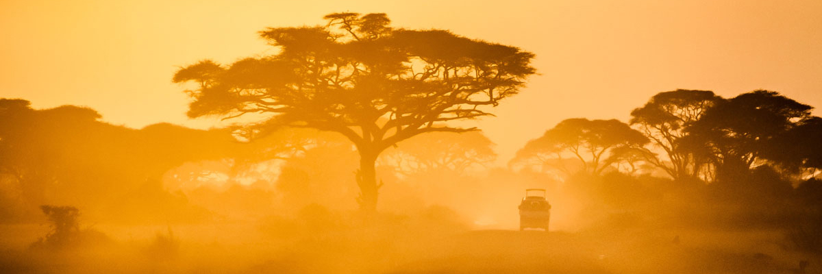
More than two million people are in need of food aid. Estimates of severely malnourished pregnant mothers and children have topped 350,000. Approximately 175,000 children are unable to attend pre-primary and primary schools due to the drought, according to a UNICEF estimate. On February 10th, 2017, Kenya’s President Uhuru Kenyatta declared a national emergency. And on March 9th, the president called for the temporary closing of schools in drought-stricken areas.
Key findings
- The Government of Kenya has declared the country’s drought a national emergency.
- The areas with the lowest rainfall in this drought are in the northwest and southeast parts of the country.
- Scientists with World Weather Attribution used multiple methods of attribution science to look at the possible roles climate change and the ENSO signal played in the drought.
- Trends indicate that the temperatures involved in this drought are hotter than they would have been without the influence of climate change.
- There is no detectable trend in rainfall, but the team cannot exclude small changes in the risk of poor rains linked to climate change.
Event
The indications of the impending drought began in 2016. Kenya receives the majority of its rainfall during two periods: the “long rains” from March, April and May (MAM) and the “short rains” from October, November and December (OND). However, in 2016 the OND rains failed. Counties in the northwest and southeast regions were particularly badly hit. The southeast also suffered from poor MAM rains.


Analysis
Researchers considered the counties classified as “alarm stage” by the National Drought Management Authority (NMDA). Based on precipitation trends and meteorological zones, two regions were defined for this analysis: the northwest and southeast. The northwest region includes the counties of Turkana and Marsabit, and the southeast includes Kwale, Kilifi, Mombasa and Lamu. In the northwest the researchers analysed the very dry 2016 OND rains, and in the southeast the researchers considered 2016’s dry OND rains, and the particularly dry year January-December 2016 [Figure 1 Panel A, B].
To assess the extent to which climate change has played a role in the drought, the WWA team conducted independent assessments using three peer-reviewed approaches: (1) statistical analyses of historical observational datasets, (2) data from global climate models, and (3) a large ensemble of simulations of possible weather scenarios with a regional climate model. Analyzing the event using multiple methods provides a means to assess confidence in the results.
Gridded observational data from CHIRPS and CenTrends were combined and analysed to provide insight into past trends and the present situation. Data from weather stations with the longest historical record in the northwest (Marsabit) and southeast (Lamu) were also analysed to put the regional results in a more localised context.
The suite of climate models used for this analysis are EC-Earth, HadGEM3-A and weather@home. For EC-Earth, which is a coupled atmosphere-ocean model with a resolution of T159 (about 125 km), a 16-member ensemble of continuous simulations from 1860-2015 is used as per the CMIP5 historical setup until 2005 and the RCP8.5 scenario from 2006. HadGEM3-A is an atmosphere-only GCM with about 60 km horizontal resolution. This model includes both historical simulations as per EC-Earth and historicalNat simulations with only non-human caused forcings. This model is only used for the northwest region, as it did not satisfy the model validation for the southeast region. A simple bias correction was used for EC-Earth and HadGEM3-A’s 2016 output.
For the weather@home regional atmosphere-only climate model at 50km resolution, thousands of simulations were run to obtain large statistics of possible weather under two different scenarios: the Actual (current greenhouse gases concentrations, observed sea surface temperatures and sea-ice extent) scenario and the Natural (pre-industrial levels of greenhouse gas concentrations, sea surface temperatures without human-induced warming patterns and maximum sea-ice extent) scenario. A reference dataset of Actual simulations (1987-2009) was analysed to contextualise the 2016 simulation outputs. As the weather@home model is more biased to the southeast being dry and the northwest being wet, model data was compared to the return period of the observed event rather than the absolute rainfall amount.
Two key outputs from these analyses determined the return time of the current drought, and looked at how the likelihood of the event has changed due to global warming. Where appropriate, comparisons were made to the 2010-11 drought, a recent and devastating event fresh in the memory of many Kenyans. The data was analysed over the period which had the most severe deficits, which was from October 2010 to June 2011.
Results
The current drought in Kenya is an extreme event, but not as extreme as the 2010-11 drought. In the southeast, the lack of OND rains in 2016 amplified the already existing drought conditions due to low rainfall there earlier in that year. According to the CenTrends and CHIRPS data, in the southeast, the lack of OND rains in 2016 is expected to occur once every four years while the overall lack of rainfall in 2016 is expected to happen once every five years. This return time was compared to that of the 2010-11 drought, although the data was analysed over a different time period. The much worse 2010-11 drought is expected to occur less frequently than once every 50 years. By contrast, in the northwest the failed OND rains in 2016 are expected to return once every three years. This return time is much less severe compared to the 2010-11 drought’s expected return time of 60 years.
The 2016 rainfall deficit at specific stations was much less likely than the area’s average rainfall. In Lamu this is expected to occur less than once in 120 years and in Marsabit around once in 12 years. This indicates that although the 2016 event may not appear to be an extremely dry year over the spatial average of rainfall, individual locations may have had little to no rain.
When considering the influence of El Niño and La Niña on the current drought, which are (respectively) positively and negatively correlated with precipitation in Kenya[3], 2016’s La Niña influence is expected to create drier conditions. In the northwest, the correlation between La Niña (NINO3.4 index) and the precipitation series shows that 16 percent of the variance in OND precipitation was explained by La Niña. Without the presence of La Niña, the average daily precipitation is estimated to have been higher at 0.89mm/day instead of the observed 0.62mm/day. In the southeast, La Niña’s influence explains 17 percent of the September-November precipitation patterns, however it has less influence over the whole year. Without La Niña, daily average precipitation for the year 2016 is estimated to have been slightly higher, at 2.0mm/day instead of 1.9mm/day.


When considering the influence of human-induced climate change on the current drought in Kenya, the results from the suite of climate models differ. The EC-Earth model output indicates a small trend towards less precipitation in the southeast: in 1920 such an event would have occurred once every seven years instead of the current expected return time of five years, and without La Niña, the drought is estimated to be less extreme (wetter), with an expected return time of three years. By contrast, in northwestern Kenya, EC-Earth estimates a return time of six years; however there is no significant trend. Results from a different model, HadGEM3-A, indicate a longer return time of 33 years for the event in the northwest of Kenya. There is a small indication of increased future precipitation making the current drought less likely today compared to 1920 with a return time of eight years. While the La Niña influence cannot be calculated from EC-Earth output in the northwest due to the low correlation with the NINO3.4 index, HadGEM3-A suggests that 10 percent of precipitation variance is explained by La Niña. In a non-La Niña year the drought is estimated to have been less extreme, occurring more often, once every three years.
Comparing the large ensemble of weather@home simulations of OND 2016 the simulations are significantly drier than the model climatology (1986-2009) highlighting a strong influence of sea-surface temperatures as observed in 2016 on the likelihood of the event.
La Niña may have had a strong influence during the 2016 OND rainfall as the correlation between NINO3.4 and the simulations is significant, particularly in the southeast. The simulations indicate that the current drought is more likely to occur with the sea surface temperature (SST) patterns in 2016 compared to the 1986-2009 climatology. A one-in-four year event in the southeast becomes at least three times more likely and a one-in-three year event in the northwest becomes at least twice as likely when specifying the 2016 SSTs.
However, comparing the 2016 simulations of the observed event with simulations of a year 2016 as it might have been without human-induced climate change shows that the drought would have been a rarer event in the Actual simulations compared to the Natural simulations. In the current climate, a drought like 2016 is thus rendered 19 – 29 percent less likely in the northwest and 29 – 39 percent less likely in the southeast than without climate change.
The weather@home simulations were also analysed for temperature effects, precipitation minus evaporation and soil moisture in the top 10 cm of soil. The simulations indicate higher temperatures in the Actual 2016 compared to Natural 2016 simulations as well as compared to climatology. Higher temperatures likely exacerbate the effects of drought.
Vulnerability and exposure
On February 10th, 2017 the Government of Kenya declared the drought affecting 23 arid and semi-arid counties in Kenya a national disaster. About 2.7 million people are currently estimated to need food aid, representing approximately 20 percent of the population in pastoral areas and 18 percent in marginal agricultural areas. According to UNICEF, this number is expected to rise to four million people by April 2017. In neighboring Somalia and Ethiopia, an even larger number of people are affected, with 2.9 million people in Somalia and 5.6 million people in Ethiopia requiring emergency food aid.
This is not the first time reduced rainfall has resulted in a crisis, the deadly 2010-11 La Niña-driven drought is fresh in the minds of many East Africans. The National Drought Management Authority was established in Kenya following the 2010-11 drought to ensure a coordinated effort to manage drought risk in the future.
Kenya is highly vulnerable to drought. Only 20 percent of the country receives high and regular rainfall. The remaining 80 percent is characterised as arid and semi-arid lands where rainfall is highly variable and drought is a regular feature of the climate. The arid and semi-arid lands house more than half of all livestock in Kenya and more than a quarter (30 percent) of the population; these are amongst the most vulnerable populations to rainfall variability and drought.
Both the rural and urban poor in Kenya are vulnerable to climate extremes. The urban poor often reside in informal settlements with limited access to public works such as electricity, water and sanitation facilities and adequate housing. The revised IFRC appeal of February 2017 notes that the current drought is leading to fears of decreased power and water supply to some of Kenya’s cities, including Nairobi.
The rural poor are impacted by failed rains that greatly reduce agricultural production and grazing lands for pastoralist communities. In addition to immediate effects, this can increase household vulnerability to future climate shocks and food security. Drought also imposes social costs on pastoralist households, whose social standing is often gauged through the size of their livestock herds.
On March 8th, 2017 President Uhuru Kenyatta launched four initiatives focused on reducing the impacts of the drought on Kenyans, especially pastoralists, through livestock insurance payouts, a new vaccine for a common livestock disease, an enhanced livestock take-off exercise and cash transfer programme. The government allocated $103 million to tackle the drought. The Kenya Red Cross Society has started a cash transfer and livestock destocking programme that assists pastoralists with weak livestock. KRCS buys livestock above its market value, and then returns the animals to vulnerable households as meat. The Hunger Safety Net Program has increased emergency cash transfers to households in 21 counties. The Ministry of Water is undertaking water trucking to 15 counties. FEWS Net states that the current ongoing humanitarian interventions, especially across pastoral areas, are likely positively impacting food insecurity outcomes.
Hotter than normal temperatures have accelerated forage and water depletion across most of the pastoral and marginal agricultural areas. This additional stressor was found to have increased in likelihood due to climate change and will have implications during future extreme heat and drought events, as well as for livelihood activities such as crop production. The lack of significant climate change signal for precipitation in the areas studied compounds the importance of managing climate variability–the regular year-to-year shifts in climate. In addition, the dominant influence of predictable climate patterns, such as La Niña, during the 2015-16 drought implies a high potential for using forecasts to trigger preventative actions, before the onset of the meteorological event.
Scientific parameters
| Variable | Precipitation |
|---|---|
| Event definition | Drought in NW and SE regions of Kenya Jan-Dec 2016, with particular focus on 2016 OND seasonComparison done with 2011 Kenyan drought: 2010 OND through June 2011 |
| Domain | Regions of Kenya:NW: Counties Turkana and Marsabit and SE: Counties Kwale, Kilifi and Lamu |
| Observational data | Two gridded datasets:Daily CHIRPS dataset (1981-2016)
Monthly CenTrends dataset (1900-2014) Station data from Kenyan Meteorological Department, extended back in time using monthly NOAA’s GHCN datasets: NW: Lodwar (1920-2016) and Marsabit (1918-2016) SE: Lamu (1906-2016) were used |
| Models used | weather@home (HadRM3P) at 50km resolutionEC-Earth T159, about 125km resolution
HadGEM3-A, about 60km resolution |
| Results | The dominant influence on the current drought is due to current SST patterns (for example, La Niña).
Temperature trends indicate that this drought is hotter than it would have been without climate change. There is no detectable trend in rainfall, but the team cannot exclude small changes in the risk of poor rains linked to climate change. All methods apart from EC-Earth in SE Kenya show either no trend or a decrease in likelihood of the drought. The station results indicate that the 2010-11 drought was worse than the current drought in Lamu and comparable to the current drought in Marsabit. |
References
FEWS Net, ongoing. East Africa: Kenya.
FEWS Net, January 2017. Pastoral areas to experience worst food insecurity outcomes as the dry season progresses.
Food and Agricultural Organization of the United Nations. (2017) Prices of cereals on the rise and at very high levels in several countries of the subregion on the back of drought-reduced harvests. In: FPMA Bulletin: 14, February 2017, 10–11.
Government of Kenya, 2013. National Climate Change Action Plan 2013-2017.
HSNP, 2017. HSNP delivers Kshs. 214 million to 79,313 households.
International Federation of Red Cross and Red Crescent Societies. Revised Emergency appeal Kenya: Drought.
Kenya Red Cross, Press release: drought appeal, Kenya Red Cross Society: Nairobi, 27 January 2017.
Mbogo, E., Inganga, F. and Maina, J.M. (2014) Drought conditions and management strategies in Kenya. Integrated Drought Management Program.
National Drought Management Authority, January 2017. 2.7m in need of relief assistance as drought ravages ASAL counties.
Nicholson, S.E. and Selato, J.C. (2000) The influence of La Niña on African rainfall. International Journal of Climatology, 20: 1761–1766 2000. doi: 10.1002/1097-0088(20001130)20:14<1761::AID-JOC580>3.0.CO;2-W
ReliefWeb. Kenya: Drought – 2014-2018. Glide: DR-2014-000131-KEN
ReliefWeb, February 2017. Horn of Africa: A call for action.
Reuters, 10 February 2017. Kenya declares drought a national disaster, appeals for local and international help.
The Presidency: The Official Website of the Government of Kenya, February 10, 2017. Government declares drought a national disaster.
The Presidency: Official Website of the President, March 8 2017. President Kenyatta launches drought mitigation programs.
World Food Programme East & Central Africa, 20 February 2017. Horn of Africa Drought Crisis Situation Report #02.


