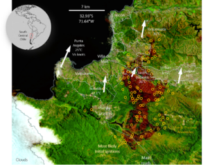
During the early days of February 2024, a low-pressure system formed along the coast of central Chile, a well-known phenomenon affecting the western coast of subtropical South America, known as the coastal low.
It leads to clear skies and high temperatures as well as strong winds due to an inverted pressure gradient between an intense subtropical high extending well into midlatitudes and the coastal low farther north. These conditions are highly conducive to wildfires i.e favour spread, especially during summer when conditions are warmer and drier. On February 2, 2024, wildfires ignited in the mountainous forested areas east of, forested areas east of the city Viña del Mar and around Lake Peñuelas.
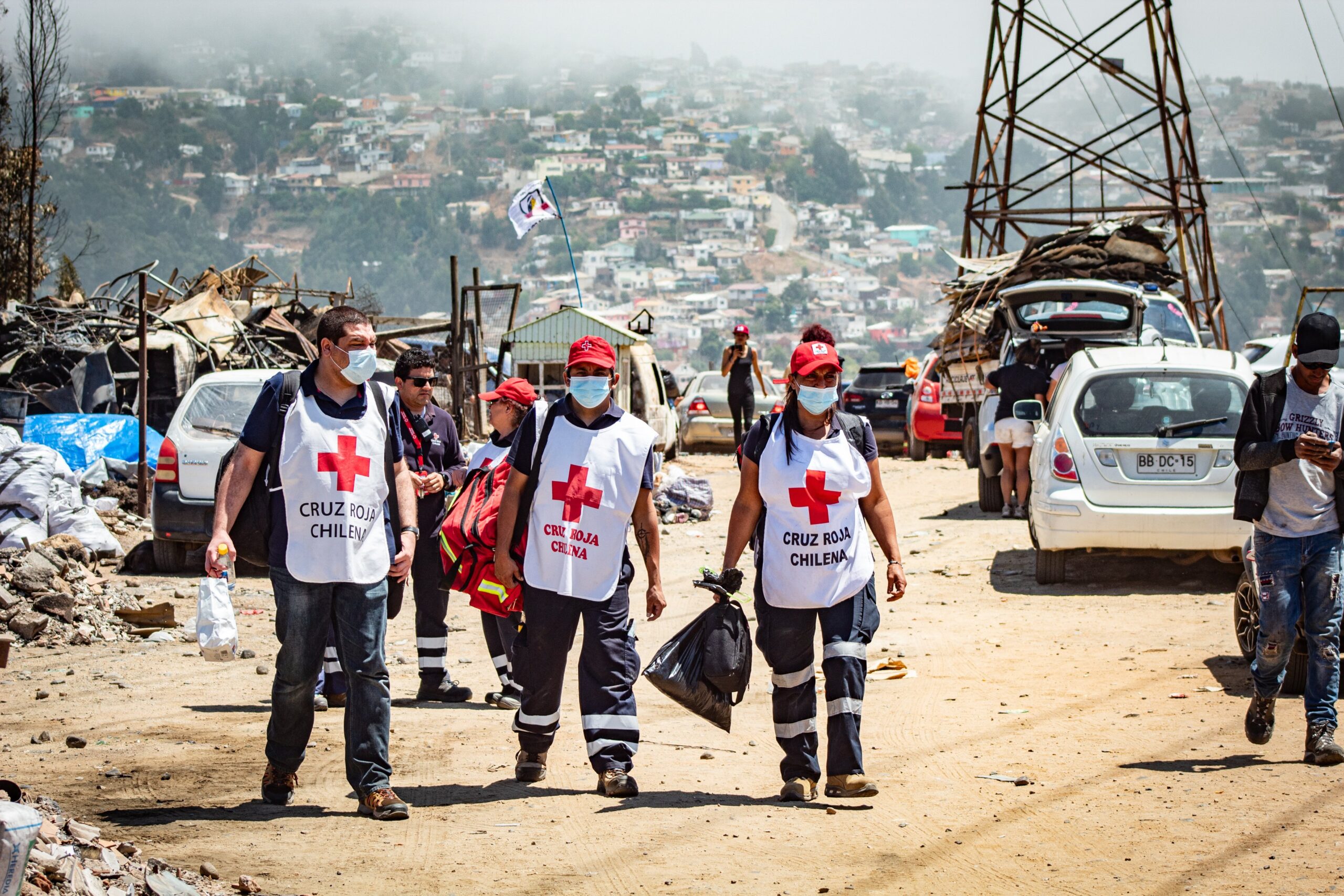
The flames rapidly advanced into densely populated city outskirts despite authorities’ efforts to curb their spread. The humanitarian impact continues to worsen, with over 29,000 hectares burnt since February 4, resulting in 132 deaths, 300 missing, 7,200 houses destroyed and 40,000 people affected.
Researchers from Chile, Brazil, Colombia, the Netherlands, Germany, Sweden and the United Kingdom collaborated to assess to what extent human-induced climate change altered the likelihood and intensity of the weather conditions at the time of the fires, and how the conditions will be affected with further warming.
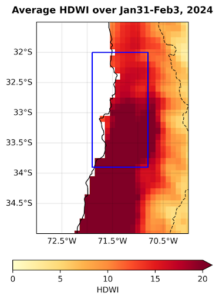
Fire weather is defined by a combination of elevated temperatures, reduced humidity, minimal rainfall, and heightened winds persisting over a period. To capture the characteristics of this event, we use a fire weather index (HDWI) based on high wind speeds, high temperatures and low humidity. While not taking the build-up of fuel into account like other, more complex indices, it is an effective hazard metric for estimating threat to communities and difficulty of containment. We focussed on a coastal region affected by the wildfires that include Valparaíso and Viña del Mar.
Figure 2 shows the index values for the four days of highest fire intensity, when most impacts occurred.
Main findings
- There is significant interaction between extreme climate conditions and land management policies, leading to particularly devastating impacts in informal settlements.
- Fire weather is one important factor that drives wildfires, although changes in vegetation (wildfire fuel), ignition factors, and fire management strategies also contribute to future wildfire risk (‘risk’ refers to the combination of hazard, exposure and vulnerability, following common usage in climate science).
- To combine the different variables leading to high fire danger we compute the hot dry windy index (HDWI) that combines high temperatures, high wind speeds and low humidity. In this index, we find that the hot, dry and windy conditions that drove the wildfires of February 2024 are characterised as a 1 in 30-year event in today’s climate.
- To assess the role of climate change, we combine observation-based products and climate models and assess changes in the likelihood and intensity of a 1-in-30-year 4-day event over the region of the most devastating fires (fig. 2).
- We find that overall, there is a small increase in the HDWI in the observations and some models, but it is not significant. This is also true for the individual components of the index: maximum temperature, relative humidity and wind speed, none of which show a significant trend.
- These results are not surprising, given the coastal location of the region which has a well established wind-driven sea surface temperature cooling.
- The fires occurred in the coastal range of central Chile, right in the transition of coastal cooling and inland warming, rendering it difficult for most climate models to represent the event well. Only 5 models were able to simulate the event, and only 2 of these perform well in the model evaluation, thus results are very uncertain. Furthermore, the observation-based data are also comparably short and highly uncertain, particularly with respect to the wind component.
- Nevertheless, unless the world rapidly stops burning fossil fuels, fire danger due to high HDWI will increase. Using the same limited models as above, in a world 2°C warmer than preindustrial, the trend towards higher HDWI becomes significant.
- We conclude that despite the trend in HDWI not yet being significant, the risk of an increase in dangerous fire weather conditions attributable to human-induced climate change needs to be taken very seriously.
- We then assess to what extent El Niño is related to dangerous fire weather conditions. We test two different indices to characterise the influence of El Niño and find that El Niño has no significant influence on the HDWI.
- Across the studied area, fire risk is increasing notably due to current land management practices, such as the expansion of Wildland-Urban Interface areas (including the growth of informal settlements in forest zones) and widespread conversion from native to foreign and monoculture plantations.
- The existing investments in fire prevention and adaptation measures, coupled with low-risk perception among residents in fire-prone areas, have shown limited effectiveness in adequately mitigating the fire risk.
- Spared by the deadly flames, the pilot fireproofing program of Villa Botania
showcases the life-saving potential of preparedness, including measures such as community-led vegetation control, embedding water points across the land, and robust emergency training. - Measures to address the significant fire risk should encompass improved spatial planning; enhanced coordination, resource allocation, and community engagement in fire prevention and adaptation; and awareness raising campaigns


