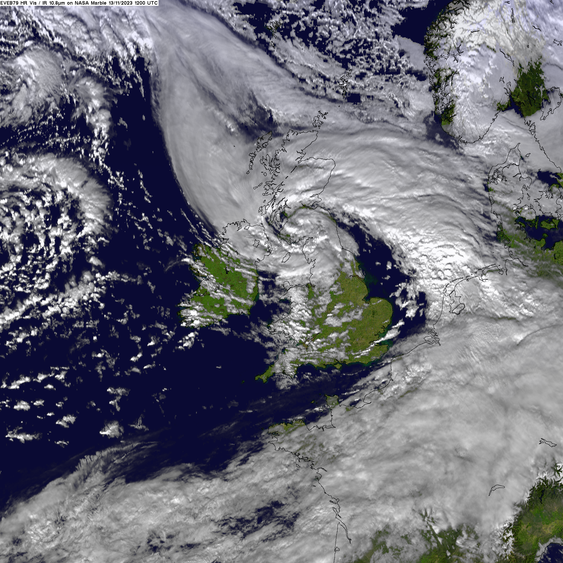
Storms of this nature are common over the European region during Autumn and Winter, being low atmospheric pressure systems that typically develop over the North Atlantic Ocean, then move eastwards over Europe bringing strong winds accompanied in cases by heavy rainfall. The storminess of the 2023-24 season has been primarily dictated by the position and strength of the jet stream, a band of strong westerly winds high up in the atmosphere driven by temperature differences between the equator and the poles, and tends to be strongest in winter. The position and strength of the jet stream influences how many low-pressure systems are directed towards Ireland and the UK. The strength of the jet stream, and how each individual low-pressure system interacts with it, determines whether these low-pressure systems intensify enough to become Atlantic storms. During the 2023-24 season, the jet stream was stronger than normal, which likely contributed to how strong the storms became. Impacts of individual storms can be worsened when the soils are already very wet due to preceding sustained rainfall or a succession of storms over a similar area, leading to saturation, increased run-off and risk of flooding.
The 2023/24 storm season is the ninth season since the founding of the Western Europe storm naming group. The initiative began in 2015, when the Met Office and Met Éireann, Ireland’s national meteorological service, officially started to identify and name storms that have the potential to cause medium or high impacts, and expanded to include the Royal Netherlands Meteorological Institute (KNMI) in 2019.
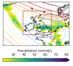
Scientists from the United Kingdom, Ireland, the Netherlands, Sweden and Germany, including scientists from each of the National Meteorological Services in the Western Europe storm naming group, collaborated to assess to what extent human induced climate change and the North Atlantic Oscillation (NAO) influenced the average storm severity, using the wind-based Storm Severity Index (SSI) over a wide region encompassing the United Kingdom and Ireland. The study also investigated the influence of climate change on the average precipitation on stormy days from October 2023 to March 2024, which was one of wettest Oct-Mar periods on record for the UK and the third on record for Ireland, and the wettest over the region south of 54N studied. The study uses peer-reviewed methods to assess changes in storm severity, associated precipitation and precipitation accumulated over the storm season.
![A figure showing Seasonal precipitation anomaly [%] relative to the Oct-Mar average over the years 1991/1992 to 2020/2021. Source: Met Office HadUK-Grid and Met Éireann’s gridded precipitation datasets.](http://www.worldweatherattribution.org/wp-content/uploads/UK-Ireland-269x300.png)
Main findings
-
- The 2023/24 storm season, studied here by stormy day wind severity, associated rainfall, and accumulated seasonal rainfall in October-March, has brought deaths, flooding, transport disruptions and power outages, among other impacts, to the UK and Ireland.
- Successive floods have compounded impacts on the agriculture and housing sectors, leading to cascading impacts on socioeconomic and psychosocial health, and eroding people’s coping capacity, particularly low-income groups. Combined with the cost-of-living crisis, the successive flood events are another layer of disruption at a time when people’s financial resilience is already being tested.
- The storm severity index (SSI) was used to define stormy days to study. The SSI considers both the strength of the wind and the area affected. In this analysis we looked at rainfall and wind speed on stormy days identified by the SSI.
- In today’s climate with 1.2C of warming, stormy days with winds as intense as in the 2023/24 season occur about every 4 years. The associated precipitation is expected to occur about once every 5 years. The seasonal precipitation of the October-March period was more extreme, expected to occur about once every 20 years.
- Analyses of observations are used to determine whether a trend can be observed in these measures. To determine the role of climate change in these observed changes, we combine observations with climate models.
- The average precipitation on stormy days are observed to have become approximately 30% more intense, compared to a 1.2C cooler pre-industrial climate. Models agree on the direction of change, combining observations and models indicate that average precipitation on stormy days increased by about 20% due to human induced climate change, or equivalently the 2023/24 level has become about a factor of 10 more likely.
- The observed precipitation across Oct-Mar has a strong trend, with a magnitude increase of about 25%. Climate models utilised in this study broadly agree on the direction of the change, and the combination of observation and model results indicates an increase in magnitude of 6% to 25%, or equivalently the 2023/24 level has become at least a factor of 4 more likely.
- Models indicate that the trends in average precipitation on stormy days and seasonal precipitation continue into the future, in a climate that is 0.8C warmer than now. Average precipitation on stormy days becomes about another factor of 1.6 times more likely, or 4% more intense, and seasonal precipitation becomes about a factor of 1.5 more likely or 2% more intense.
- Looking at average SSI on storm days, while some studies using other methods suggest an increase in storminess in a future climate, our analysis has shown a decreasing trend. Our results show that average SSI indices as observed this year became about a factor of 2 less likely. The synthesis of the models also shows a negative trend and, when combined with observations, the results indicate that a stormy season as observed this year is nowadays a factor of about 1.4 less likely due to human induced climate change.
- This highlights the need for ongoing research into how climate change may influence the severity and frequency of windstorms in northern Europe.
- NAO is a key driver of ‘storminess’ and has been accounted for in this analysis. However, the Oct-Mar 2023/24 averaged NAO was almost neutral.
- Comprehensive flood risk management is required in the UK and Ireland that encompasses legislative frameworks, strategic planning, and substantial funding. Major UK cities are starting to integrate nature-based solutions into their designs. In Ireland, flood relief projects have been integrating nature-based solutions alongside traditional engineering solutions for over 20 years. Both the UK Met Office and Met Éireann are continuously improving their impact-based weather forecasting mechanisms to facilitate the translation of warning into action, in partnership with other government bodies to ensure their people’s safety.


