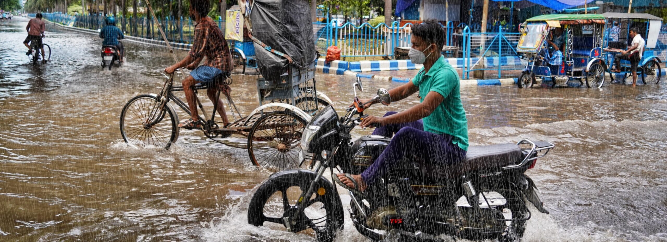

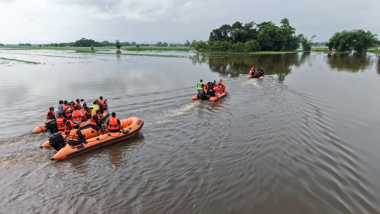
Between late June and early August 2026, the region of Upper Assam (specifically the primary districts of Sivasagar, Charaideo, and Jorhat) and the surrounding hill catchments of Nagaland and Arunachal Pradesh in Northeast India witnessed multiple spells of heavy to extremely heavy rainfall that triggered repeated waves of flash flooding and widespread inundation across the region.
An initial spell of intense rainfall around 28 June 2026 triggered a first wave of flooding, affecting more than 22,000 people across six districts and causing early infrastructure failures (The News Mill, 2026; ANI, 2026; Hindustan Times, 2026). A second and more severe period of heavy rainfall between 18 and 21 July inundated 16 districts and 794 villages, with floodwaters persisting through late July and into early August (ReliefWeb SitRep 1–4, 2026).
These events affected a region characterised by high population density in the downstream Brahmaputra Valley, alongside widespread poverty and strong dependence on agriculture. The topography of Upper Assam also increases flood risk, as its low-lying basin receives intense runoff from the neighbouring Naga and Arunachal hills. The resulting floods disrupted the lives of hundreds of thousands of people, destroyed extensive areas of cropland, and damaged critical infrastructure across the wider region (BBC, 2026; NDTV, 2026). Overall, the floods and associated landslides affected more than 500,000 people across the region. As of today, at least 99 deaths had been reported in Assam alone, while hundreds of thousands of residents were displaced into relief camps (The Economic Times, 2026; ReliefWeb SitRep 3, 2026).
Researchers from India, Sweden, the United States, the Netherlands and the United Kingdom collaborated to assess to what extent human-induced climate change altered the likelihood and intensity of extreme rainfall that led to devastating landslides and floods. To characterise the initial event as well as the subsequent flooding and effect of the saturated soils, we analyse the 3-day maximum rainfall (RX3day) and the 30-day maximum rainfall (RX30day) during the monsoon season from June to September, focusing on a region of the Upper Assam division (red outline, figure1).
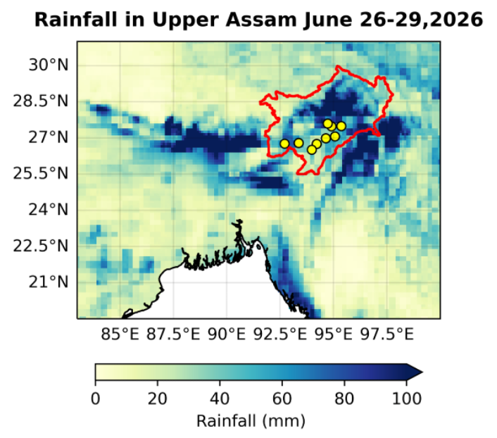
Figure 1: Extreme rainfall during the first event that led to major flooding in Assam and neighbouring states. The red outline is the study regions, dots show the location of major impacts.
Main Findings
- Floods in Assam are a recurring result of physical and structural risk rooted in the dynamics of the Brahmaputra River system. As the river descends from the Tibetan Plateau through the Eastern Himalayas into the Assam Valley, it carries vast amounts of sediment that gradually raise the riverbed, reduce channel capacity, and continually reshape sandbars, making seasonal flooding during the monsoon almost inevitable. These recurring floods repeatedly damage agriculture, infrastructure, and livelihoods, constraining long-term economic resilience. For instance, more than 45,000 hectares of cropland were submerged during the 2026 floods, while flood damage over the past decade has been estimated at INR 10,000–15,000 crore. Over 30% of the land area in Assam are protected forests and wildlife sanctuaries housing rare species such as the one-horned rhinoceros.
- Land-use changes increase the natural exposure dramatically. Evidence from a review of 35 studies suggests that unplanned urbanization, deforestation, poor drainage, inadequate structural flood management measures, and other anthropogenic changes now outweigh natural rainfall variability in explaining flood frequency. These changes have degraded wetlands, accelerated riverbank erosion, and disrupted natural drainage, increasing the severity and downstream impacts of flooding.
- The colonial and historical reorganisation of land and labour in Assam has created patterns of displacement that still influence vulnerability today. As land was appropriated for plantations and agricultural expansion, many indigenous communities were forced onto marginal lands, including flood-prone riverbanks and char areas. These locations remain among the state’s most hazard-exposed regions, meaning that the consequences of colonial land policies continue to be reflected in repeated displacement, poverty, and greater exposure to floods.
- The 2026 floods in Assam have intensified pre-existing public health vulnerabilities by disrupting primary health care services, increasing the risk of infectious disease outbreaks, and highlighting the challenges emergency medical responses can face when public health care systems have limited capacity or resources.
- Analysis of this year’s observed rainfall confirms that the rainfall associated with the floods was not exceptional in today’s climate. Both the 3-day and 30-day rainfall events in the study region have estimated return periods of only less than two years.
- To assess if human-induced climate change influenced the heavy rainfall, we first determine if there is a trend in the observations. We find that taking the available datasets together, the best estimates suggest no trends. The uncertainty in the datasets is high however, as the station density in the region is low, despite high spatial variability therefore decreasing or increasing trends cannot be excluded.
- When repeating the analysis in climate models we find similar results: that human-induced warming of 1.4°C has not materially altered the likelihood and intensity of this year’s heavy rainfall, while the models ability to reproduce the rainfall characteristics in the region is limited.
- Regardless of the uncertainties in trends in the rainfall, the impacts remain a reality urging the need for efforts to reduce vulnerability and strengthen resilience.
- Although Assam has invested heavily in structural flood-control measures such as embankments, anti-erosion spurs, town protection walls, road-cum-embankments, and wetland restoration, its reliance on rigid embankments and concrete engineering is not sufficient for adaptation. Embankments can worsen flooding by blocking natural drainage, trapping silt and raising riverbeds, and increasing the risk of severe breaches. Future adaptation will therefore need to focus less on controlling rivers and more on working with them, combining targeted engineering with floodplain restoration, wetland conservation, reducing development in floodplains, improved drainage and community-based preparedness. This would reduce reliance on rigid infrastructure while allowing landscapes to absorb and recover from flooding more safely.
- Disaster management authorities reviewed flood preparedness and damage assessment measures before the worst floods, including preparing 15 relief camps. Some districts also took anticipatory action, such as vulnerability assessments and pre-positioning flood-fighting materials in Sivasagar. Future adaptation could build on this by expanding anticipatory action across districts, using local risk assessments and early warnings to prepare resources before floods occur.